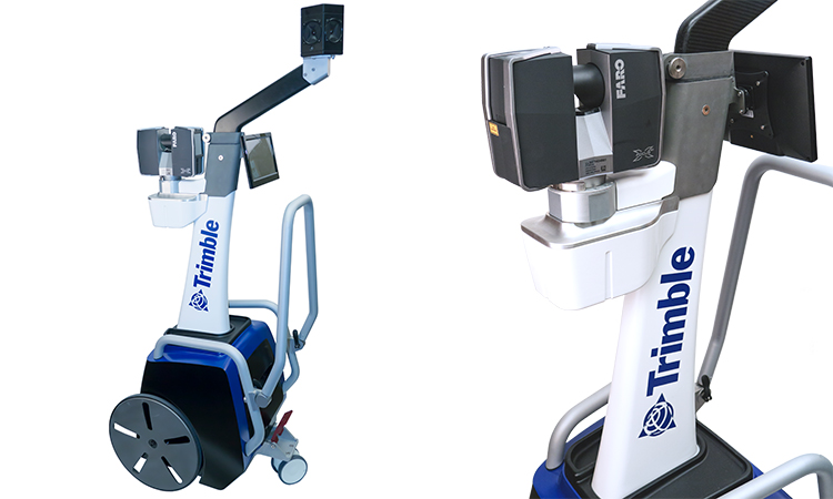
TIMMS Indoor Mapping
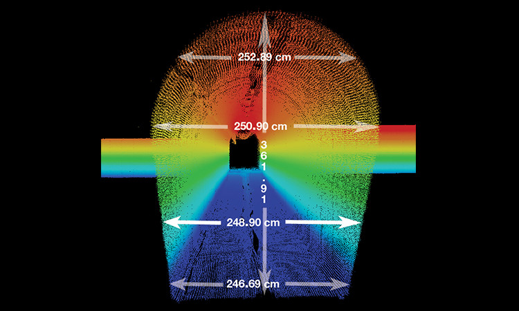
TIMMS provides both LiDAR and spherical video, enabling the creation of accurate, real-life representations (maps, models) of interior spaces and all of its contents; every object in the interior space - including desks, chairs, stairs, and doors - appear in the plan. The maps are geo-located, meaning that the real world positions of each area of the building and its contents are known.
View Indoor Visualization Tour
Users can obtain holistic 3D indoor geospatial views of all kinds of infrastructure including:
- Plant and factory facilities
- High-rise office, residential, and government buildings
- Airports, train stations and other transportation facilities
- Music halls, theatres, auditoriums and other public event spaces
- Covered pedestrian concourses (above and below ground) with platforms, corridors, stair locations and ramps
- Underground mines and tunnels
CASE STUDIES »
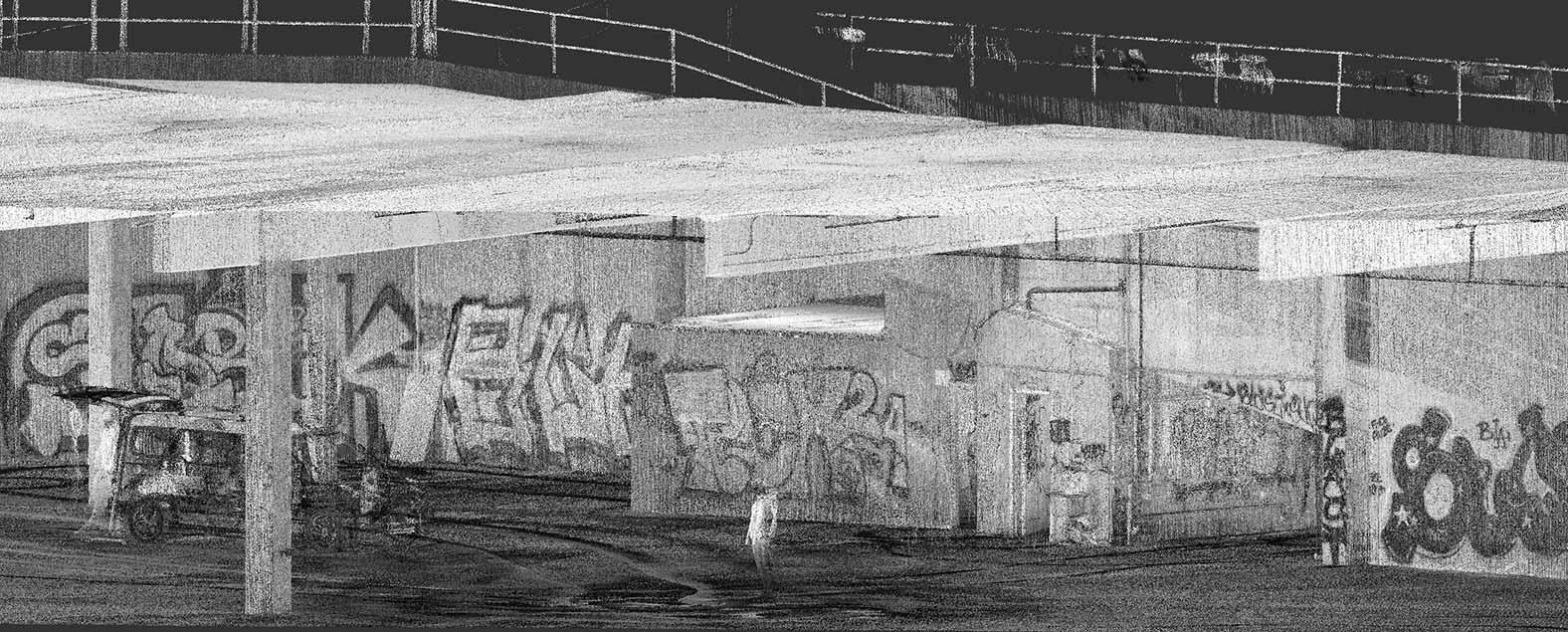
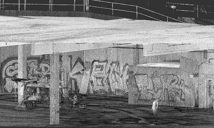
3D Point-Cloud map of Californian building with graffiti, produced by the TIMMS. Photo courtesy of Contoured Inc.
|
Features
|
Benefits
|
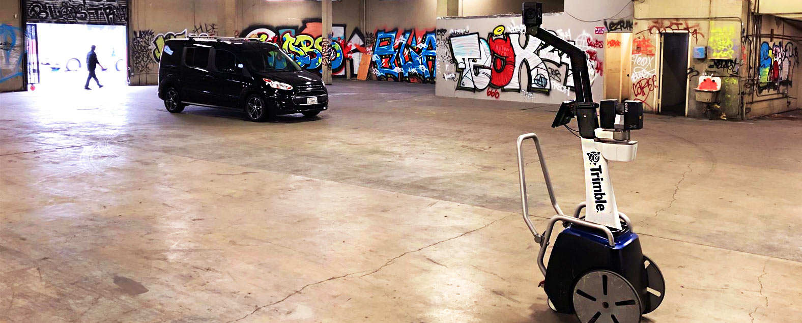
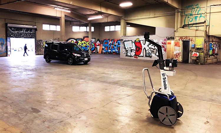
Trimble Indoors Mobile Mapping Solution (TIMMS) surveying a building with graffiti in California. Photo courtesy of Contoured Inc.
The Trimble Indoor Mobile Mapping Solution (TIMMS) is fully compatible with Solv3D visualization software.
SOLV3D encompass (Encompass) is a web-based solution for empowering data consolidation, visualization and collaboration. With the ability to bring together geospatial datasets from many sources, Encompass provides a wholistic view in which visualization and collaboration between team members is intuitive and easy, yet incredibly powerful.
For additional information including pricing or product demonstration, please contact Solv3D by visiting their website.
View Indoor Visualization Tour
Learn more about how Solv3d Visualization Tour works here:
How Solv3d Works
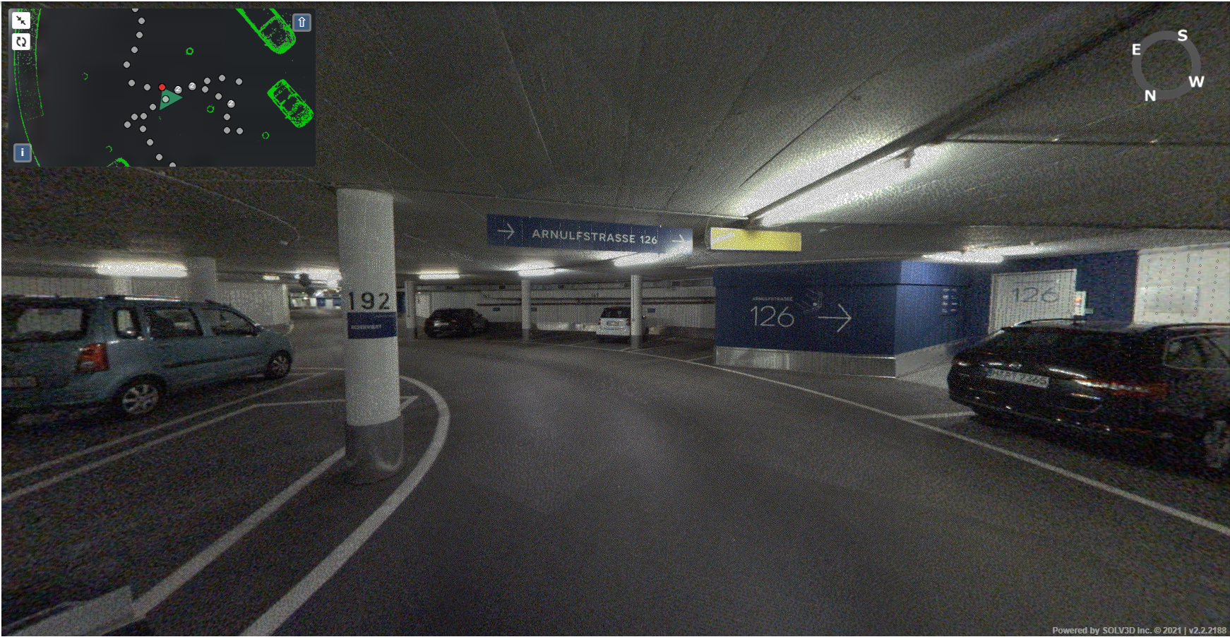
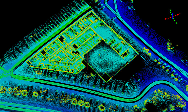
Sample of Solv3d visualization, produced by the TIMMS.
Contact your local dealer for more information on TIMMS service in your area:
|
|
|
 Oliver Reichl, Bayern Drohne